BLM Closes Tikaboo Peak — Area 51's Last Legal Public Vantage Point — Citing Safety Hazards
The Bureau of Land Management authorized a temporary closure of approximately 22,987 acres surrounding Tikaboo Peak in Lincoln County, Nevada on March 25, 2026, removing public access to the only remaining spot from which Area 51 can legally be observed. The closure, documented under BLM NEPA project DOI-BLM-NV-L030-2026-0005-CE, cites safety hazards and is listed as lasting a minimum of one year, subject to reevaluation pending hazard assessment.
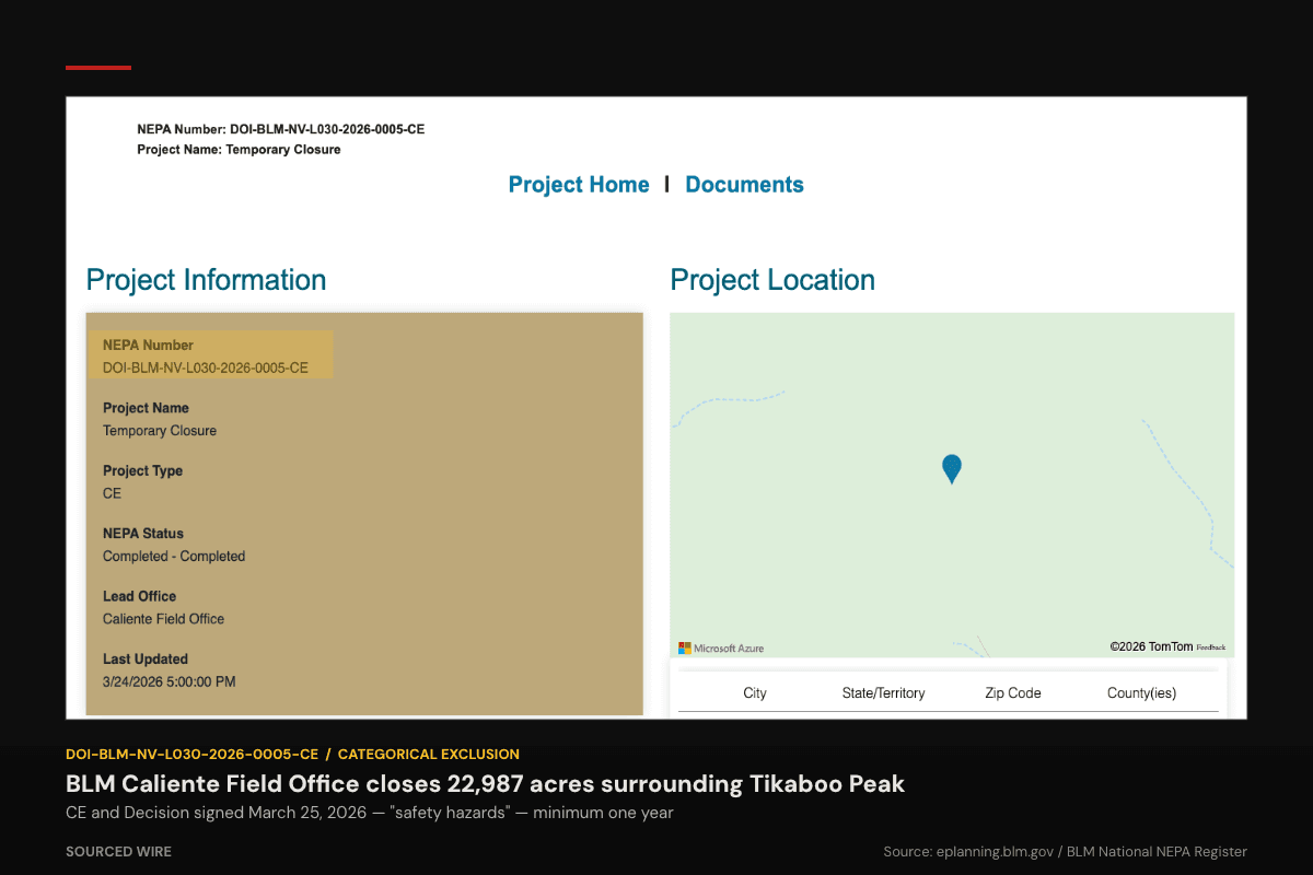
The Bureau of Land Management has closed Tikaboo Peak — long the only publicly accessible vantage point overlooking the Nevada Test and Training Range, which includes the classified Groom Lake facility widely known as Area 51 — to all public access.
The BLM's Caliente Field Office authorized the closure on March 25, 2026 under a Categorical Exclusion from full environmental review, designating the action as NEPA project DOI-BLM-NV-L030-2026-0005-CE. The closure covers approximately 22,987 acres of public land surrounding Tikaboo Peak in Lincoln County, Nevada. BLM listed the stated reason as safety hazards. The Decision Record states the closure is "effective for one year," and the Categorical Exclusion describes it as "lasting a minimum of one year, and limited to this specific area and subject to reevaluation pending hazard assessment."
Tikaboo Peak, located roughly 26 miles east of Groom Lake, had held its status as the closest legal public observation point for Area 51 since 1995. In that year, the Air Force expanded the restricted zone around Groom Lake to absorb Freedom Ridge and White Sides Mountain — two previous public vantage points widely used by aviation enthusiasts and journalists — citing the volume of photography being taken from them. Tikaboo Peak, at a greater distance, remained outside the restricted boundary and became the default observation point.
Long-range photographs and video of flight operations at Groom Lake taken from Tikaboo's summit have appeared in published books, aviation magazines, and enthusiast forums for more than two decades. The BLM's March 25 action brings Tikaboo's accessible era to a close — for at least one year, and potentially longer depending on reevaluation.
Timing and context
The closure was authorized nearly two weeks before Polish aviation enthusiast Michal Miroslaw Rokita traveled to Nevada on April 7, 2026. Rokita subsequently photographed and recorded the Nevada Test and Training Range from Tikaboo Peak and, on April 11, joined a livestream on the Dreamland Resort YouTube channel in which he displayed that footage. He was arrested, pleaded guilty to two counts under 18 U.S.C. § 795 — the 1948 statute prohibiting photography of designated defense installations without authorization — and was sentenced to time served by U.S. Magistrate Judge Maximiliano D. Couvillier III on April 21, 2026.
The BLM action therefore precedes the Rokita prosecution. Both actions reduced public access to the Nevada Test and Training Range in the same period — one through land closure, the other through criminal enforcement of a rarely used federal statute.
What the closure eliminates
Because the 2026 closure covers the public land surrounding Tikaboo Peak rather than just the trail itself, access to the summit's viewshed is blocked regardless of approach route. The Decision Record cites "increased foot traffic," steep and "dangerously unstable" terrain, the remoteness of the area for search-and-rescue response, and the presence of Desert Research Institute weather monitoring equipment as the basis for closure. The Categorical Exclusion does not identify any specific accident or incident, noting only that "no serious accidents or injuries have occurred in recent years" but that "prevailing conditions and increased foot traffic raise the risk of injury events."
Prior BLM expansions of the restricted zone in 1995 were contiguous with the existing military withdrawal boundary; the Tikaboo closure creates a public-land restriction that is geographically separated from the NTTR's outer boundary by miles of open desert, an unusual configuration that may invite scrutiny under the Federal Land Policy and Management Act's requirements for public land closures. The Decision Record notes the closure may be appealed to the Interior Board of Land Appeals under 43 CFR Part 4.
No formal challenge had been filed as of this reporting.